Quantcast
 
 
Make Memories Galore in Hampton Beach, NH in 2024! Click for beach cams & more information.

Walking and hiking are a pleasure in many settings and locales

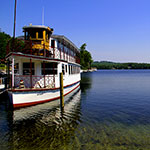
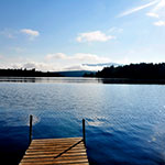
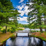
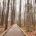
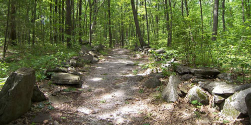
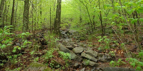
From strolling in a historic downtown to hiking up a steep mountainside, New Hampshire offers more places to enjoy the state on foot that you can imagine. Most of the state parks, including in rugged and mountainous areas, welcome hikers and walkers of every level of skill and strength. Besides mountain walks, there are easy walks near beaches and salt marshes, and walks in historic downtown neighborhoods. Enjoy a nature walk or rigorous hike with the family lodging to see New England beauty up close.

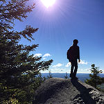
Featured Article: Scenic Mountain Hiking in New Hampshire's Great North Woods

Mt-Washington-credit-NH Division of Travel and Tourism Development
Mountain Hike with the Dog - Town of Bethlehem, NH - Photo Credit The Rocks NH
Town of Bethlehem

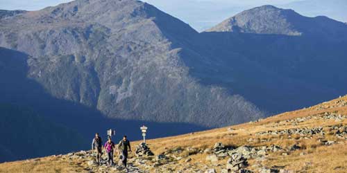
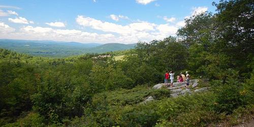
There’s a happy trail for every hiker in this picturesque region of New Hampshire

Happy trails are everywhere around Bethlehem, NH. Whether you’re looking for a gentle loop for a little exercise before a picnic lunch, a paved pathway or a challenging trail to a mountaintop, this spectacular area in the White Mountains has great locations for every hiker. There are trails that border rivers, or take you through pine forests, trails where you might see a beaver or other wildlife – even a trail that takes you to a Christmas tree farm. Check out the giant white pine tree, more than 200 years old, in Bretzfelder Memorial Park with several trail loops, or the Mount Agassiz Trail to the top of the mountain. Visit The Rocks, with easy to moderate trails including the Christmas Tree Trail.
Hiking - Androscoggin Valley Chamber - Berlin, NH
Androscoggin Valley Chamber of Commerce

961 Main Street Berlin, NH, 03570 Phone: 603-228-0836

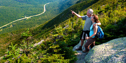
Whether you’re an ambler or a hard-core hiker, this region has trails and paths for you

Ambling through meadows, scaling mountains, trekking trails by rivers and ponds: That’s hiking in the Androscoggin Valley, New Hampshire’s most engaging outdoor playground. At Great Glen Trails, explore 28 miles of rolling carriage roads and tracks through the woods: perfect for strollers and dogs! Ask about the Trails Tracker Scavenger Hunt. Or lace up your hiking boots to hit the hundreds of miles of trails in the White Mountain National Forest, Jericho Mountain State Park and Milan Hill State Park. Over 100 miles of Appalachian Mountain Trails run through the White Mountains and the Mahoosucs. Or hike into Glen Ellis Falls in Gorham, NH, where a majestic waterfall tumbles 64 feet into an emerald-green pool. Stop at the information booth to get information on swimming holes in the area.
Trail Running - Great Glen Trails - Gorham, NH
Great Glen Trails

Route 16 at Pinkham Notch Gorham, NH, 03581 Phone: 603-466-3988

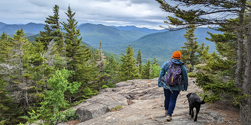
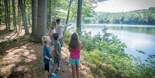
A walk in the woods has special moments for all ages and abilities of hikers

Walk and hike surrounded by the natural beauty of the White Mountains when you begin your trail adventure at Great Glen Trails Outdoor Center. The center’s 28 miles of trails include smooth, rolling carriage roads and challenging single track, so all ages and abilities find something to both relax and challenge them. The single track has easier, intermediate and challenging/expert sections; the double track has intermediate and challenging/expert sections. The trails are clearly marked, dogs are more than welcome (on their leashes, of course), and the carriage roads are suitable for strollers. It’s the perfect way to spend a day in the spring, summer or fall. Check the website for information on the spring and fall trail running/walking series for all abilities.
Hiking Trail 500x250 - America's Stonehenge - Salem, NH
America's Stonehenge

105 Haverhill Road Salem, NH, 03079 Phone: 603-893-8300

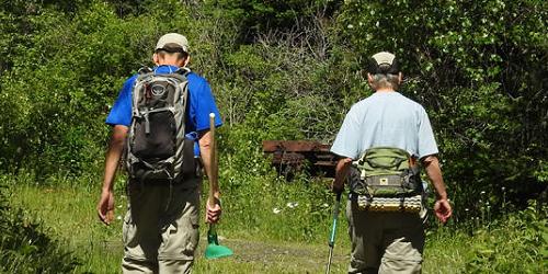
Hike in the footsteps of the continent's ancestors

A visit to America's Stonehenge in Salem, New Hampshire, is a great activity for those who enjoy hiking and walking. You'll find yourself wandering among boulders and pines in a wild but beautiful spot, about which fantastic tales might be woven. About 30 acres of these woods are an archaeological site, where you'll find ancient megaliths, stone chambers, and a weird maze of stone markers. Who built these structures? Were they colonial farmers, Native Americans, or, as some suggest, visitors from the Old World prior to Columbus who lost their way in the Atlantic Ocean and found themselves on New England's shores. Through the years scholars have suggested Phoenician mariners, ancient Druids, Vikings, or Irish wanderers. Tour the site, and give us your opinion.
Hiking by the Lake Purity Spring Resort Madison New Hampshire
Purity Spring Resort

1251 Eaton Road (Route 153) East Madison, NH, 03849 Phone: 603-367-8896 Toll-Free: 800-373-3754

Walking, strolling, hiking: Whatever you call it, there’s plenty of it at this four-season resort

Whether you prefer an easy stroll or a cardio-workout hike, there’s a trail for you when you stay at the Purity Spring Resort. Take an easy walk around the lake in the summer, get the snowshoes out and hike around a mountain at the King Pine Ski Area in the winter, or head to one of the area nature preserves with scenic trails. At the Hoyt Wildlife Sanctuary, 2.4 miles of shoreline and wooded trails include the Heath View Trail, a wetland cove home to beavers, river otters, turtles and great blue herons. Of course, hiking in New Hampshire is particularly beautiful in the fall — bring a picnic lunch and celebrate those autumn colors. Ask for trail guides and trail advice at the main office.
Crawford Notch State Park-credit-NH Division of Travel and Tourism Development
Crawford Notch State Park

1464 US Route 302 Harts Location, NH, 03812 Phone: 603-374-2272

Mountain vistas, waterfalls, rivers, mountain hiking, campground

This is a place of spectacular mountain views, hiking trails, and waterfalls. Hikers can expect to see magnificent views. Hiking map.
See full listing for Crawford Notch State Park.
great bay national esturine research reserve
Great Bay National Estuarine Research Reserve hiking trails

Discovery Center, 89 Depot Road Greenland, NH Phone:

This giant tidal bay has a Discovery Center for visitors and lots of access points and trail for walking and hiking. Visitors may hike in forests, marshes, and mudflats, accessible at Adams Point, Crommet Creek, Great Bay Discovery Center Campus, and many other coastal sites.
See full description at our New Hampshire science and nature pages.
Ahern State Park

43 Great Bay Lane Laconia, NH Phone: 603-227-8745

This lakeside park has abundant walking trails. Trail map. See full descriptionof Ahern State Park at our State and Local Parks page.
Greensboro Ridge Natural Area

Velvet Rocks Hanover, NH Phone: 603-643-3433

This 113-acre preserve crosses a beautiful landscape as it climbs up the ridge and connects with the Appalachian Trail near Velvet Rocks. Guide.
To get here: From the intersection of Route 120 and Greensboro Road, turn onto Greensboro Road. In 0.4 miles, turn left onto Velvet Rocks Drive. Continue to the trailhead parking area at the top of the road. Please respect the privacy of the residential community on your way to and from the natural area. No overnight parking is permitted at the trailhead.
Trails:
Greensboro Ridge offers an invigorating hour-long hike on a 1.5-mile loop through a classic rocky New England forest. Oli’s Eagle Trail (0.5 miles, foot travel only), connects to the Appalachian Trail in a 20-minute hike, traversing moderate terrain. Sections of the trail pass over ledges and boulders.
The Greensboro Highlands Trail (0.6 miles) meanders past dramatic mossy rock faces and more. Vertical gain is about 300 feet. The trail is for foot travel only.
The Silent Brook Trail (0.4 miles), where mountain biking is permitted in addition to hiking, connects the Silent Brook and Velvet Rocks neighborhoods and links the Greensboro Highlands Trail with Oli’s Trail. Dogs are permitted if under their owners’ control; please pick up after your pet. Hunting is permitted in season. Trail map.
Franconia-Notch-State-Park
Franconia Notch State Park

Route 93 Franconia, NH, 03580 Phone: 603-823-8800

Park in a mountain pass has a lake, bicycling, camping, daytime attractions

This magnificent park within a mountain pass has the Lafayette Campground, open mid-May to Columbus Day. The park is popular for hiking. Parking can be difficult; please see the link below for parking for hikers. Hiking map. Parking for hikers.

See full description of Franconia Notch State Park.
Odiorne Point Trail at Odiorne Point State Park

570 Ocean Blvd Rye, NH Phone: 603-227-8722

This walk through several habitats along the Gulf of Maine traces the geological history of this coast. In ancient times, Odiorne Point was covered by dense cedar forests. After the last glacier retreated it left a jumbled beachfront deposit of quartz, sandstone, shale, and lime rock. An extensive network of trails wind through the dense vegetation and traverse the park. Not far from the trails, you can picnic on the shoreline and enjoy sweeping views of the ocean. Trail map.
Please be aware that many State Park areas and trails are not staffed during the off-season, and day-use fees ($2-$4 in season) are not collected.
River Trail at the Mink Brook Natural Area

Route 10 Hanover, NH Phone: 603-643-0708

The Mink Brook Natural Area, just south of downtown Hanover, includes a gentle, one-mile river trail that follows Mink Brook, Hanover’s largest stream, to its confluence with the Connecticut River.. The trail is accessible to strollers and wheelchairs. The scenic area offers easy strolling and excellent birding, especially for waterfowl. Leashed dogs are allowed; please clean up after your dog. Foot travel only. The natural areas is managed by the Hanover Conservation Commission.
To get here: from downtown Hanover, drive south on Route 10 to the bottom of the hill. Turn right into a small parking area near an electric substation just before Route 10 crosses a bridge over Mink Brook.
Mount Sunapee State Park - Photo Credit NH State Parks & Recreation
Mount Sunapee State Park

86 Beach Access Road Newbury, NH, 03255 Phone: 603-763-5561

Year-round outdoor fun with lake and camping; near downhill ski resort

Mount Sunapee State Park has year-round activities for outdoor recreation, including hiking. Hiking map. See full description of Mount Sunapee State Park.
Dixville Notch State Park

1212 West Route 26 Dixville, NH, 03576 Phone: 603-538-6707

Dixville Notch State Park spans 127 acres. Within the park is a scenic gorge and waterfalls on two mountain brooks. Hiking trails lead to Table Rock and nearby mountains. The park is also a great spot for picnicking. Pets allowed.
Nansen Wayside Park

Route 16 Milan, NH Phone: 603-823-7722 Ext - 75

Located near the banks of the Androscoggin River, Nansen Wayside Park is a popular place for picnicking, fishing, and boating. The park spans 14 acres and is the site of the 170-foot steel-framed Nansen Ski Jump, seen towering over the area. Nansen Wayside Park is unstaffed but is open to the public year-round at no charge. There is no winter maintenance. A boat launch is available. Information: www.nhstateparks.org
Monadnock State park in Jaffrey-credit-NH Division of Travel and Tourism Development
Monadnock State Park

169 Poole Road Jaffrey, NH, 03452 Phone: 603-532-8862

Hiking on Mount Monadnock; camping; cross country skiing; open year-round

Monadnock State Park is famous for its many miles of hiking trails; it is sometimes called the most-often hiked peak in New England. Monadnock State Park is open year-round, and allows cross-country skiing in winter. Pets are not allowed in the park.
Hiking map.
Cross country ski trails map.
See full listing for Mount Mondanock State Park.
Squam Range Traverse

Mead Base Camp Sandwich, NH Phone: 603-968-7336

This is a point-to-point hike running across seven named peaks of the Squam Range in the Lakes Region of New Hampshire. There are ample opportunities for views and lots of walking (and scrambling) on open ledges. The elevation gain is 2,900 feet.
The starting point for this hike is Mead Base Camp in Sandwich, New Hampshire and the ending point is the Cotton Mountain Trailhead located in Holderness, New Hampshire. - Trail Map
Trails of Beaver Brook Association

117 Ridge Road Hollis, NH Phone: 603-465-7787

Beaver Brook Association is a protected area of 2,187 acres of forest, fields, and wetlands with 35 miles of trails. The trails are designated by blue rectangular markings for multi-use, which allows horse and bicycle traffic, and yellow triangular markings that allow only hiking and cross-country skiing. Trails are open year-round, daily, dawn to dusk.
Nesting Box Trail
BBA Hollis Trail Map
Education Corridor Map
Orienteering Course Map
Wild Flower Trail
Castle in the Clouds Conservation Area - Moultonborough, NH - Photo Credit Lakes Region Conservation Trust
Castle in the Clouds Conservation Area

455 Old Mountain Road Moultonborough, NH, 03254 Phone: 603-476-5900

The Castle in the Clouds Conservation Area is 5,000 conserved acres with 45 miles of hiking trails to waterfalls, views from mountain summits and outlooks, signs of wildlife, historic sites, and interesting geological features of the Ossipee Mountains.
This property is part of the Ossipee Mountain ring, a circular formation of volcanic origin. Seven of the Ossipee Mountains’s biggest peaks are on the Castle property, including Mount Shaw and Bald Knob, with its view of Lake Winnipesaukee. The trails are well maintained, marked, and mapped.
Two trailhead parking areas are free and open to the public for getting onto the trails during the day. One is on Route 171 and the other is at the end of Ossipee Park Road. A helpful hiking trail map is available for purchase.
Adams Point Wilderness Management Area Trails

From Adams Point Road Durham, NH Phone:

This is a pleasant and easy 1.5-mile loop hike into a peninsula jutting into the Great Bay tidal estuary, with views of the bay and sea life all around as you traverse meadows and woodlands. you can see Great Bay almost every where along the trail. Piscataqua River feeds Great Bay from the Atlantic, creating a tide-influences variety of salt marsh and tidal creek environments.
Boulder Loop Trail

Dugway Road off Kancamagus Highway Conway, NH Phone:

Boulder Loop Trail is a 3.1-mile loop trail in the forest, with lots of big boulders for kids to climb. The trail may be used from May until October. Dogs may this trail. The loop has good views from the top. Some rocky surfaces may be slippery when they are wet. In the spring or after a heavy rain, certain areas may show small washouts.
Distance & Elevation: 3.1 miles; 1750 feet
Difficulty: Moderate; fine for kids and teenagers
Bear Brook State Park

61 Deerfield Road Allenstown, NH, 03275 Phone: 603-485-9874

Full service park has water sports, camping, archery, horseback riding

This giant park has 40 miles of trails through forest, hilltops, and marches. Trails are open to hikers, mountain bikers, and horseback riders. Trail map. Trail information.
See full description of Bear Brook State Park
Portsmouth Harbor Trail Walks - Portsmouth, NH - Photo Credit Greater Portsmouth Chamber
Portsmouth Harbor Trail Walks (Guided Tours)

Market Square Kiosk at Tuscan Market Portsmouth, NH Phone: 603-610-5510

Portsmouth is a picturesque colonial-era town on the bank of the Piscataqua River with wonderful views, shops and restaurants. The trail passes more than 70 points of scenic and historic significance, including ten buildings on the National Register of Historic Buildings, ten National Historic Landmarks, and three historic homes.
Walking tours of the Portsmouth Harbor Trail from June through October can be arranged. Three separate walks take you through or past Market Square, the heart of downtown; Prescott Park on the river; Strawbery Banke; and historic churches and mansions.
Hours: Tours offered mid-May through Columbus Day, Thursdays and Saturdays starting at 1pm.
Hanover Center & Dartmouth College
Hanover and Dartmouth College

A sweet walk through a New England college town, including a short trip around a recreational pond, is yours in the center of Hanover, home to Dartmouth College. You are surrounded by both traditional and modern college building and sites, among with stores and eateries that serve the student community.
From Dartmouth Green, which is bracketed by North Main Street, East Wheelock Street and College Street, walk northward on Main Street and take a left onto Webster Street, moving through the frat house neighborhood and past the college president's house. Turn right onto Occom Ridge and pass between Occom Pond and the Connecticut River. At the end of Occom Ridge, a right turn onto Hilton Field Road and another right onto Rope Ferry Road will return you North Main Street and the center of town.
Beaver Brook Falls Wayside Park

Off Route 145 Colebrook, NH Phone: 603-538-6707

Beaver Brook Falls Wayside is 7.3 acres in size and is a popular place for hiking. The park has a scenic picnic area with picnic tables and small picnic shelters. A group use area is available. Beaver Brook Falls Wayside is unstaffed but is Open to the public year-round at no charge. No restrooms are available and all items (including trash) must be carried out with you when you leave. Pets allowed. Information: www.nhstateparks.org
Winslow State Park

475 Kearsarge Valley Road Wilmot, NH, 03287 Phone: 603-526-6168

Winslow State Park is on the northwest slope of Mount Kearsarge. The picnic area is on a high plateau with outstanding views of the White Mountains and the peaks of Vermont peaks. A one-mile foot trail leads from the picnic area to the summit of Moutt Kearsarge. A two-mile trail offers a loop walk
Red Hill

Sibley Road and Red Hill Road Center Harbor, NH Phone:

Red Hill, in the Lakes Region, is a popular hiking spot due to the stunning panoramic views from the fire tower. Hikers can see Lake Winnipesaukee to the southeast and Squam Lake to the west. This is a short hike of 1.7 miles to a fire tower; elevation gain is 1,370 feet. Low to moderate difficulty. Distance is a total of 3.5 miles.
Trail Info Sign - Echo Lake State Park - Conway, NH
Echo Lake State Park

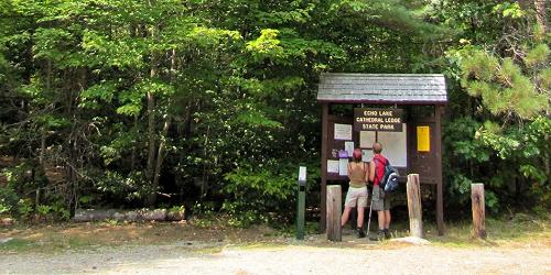
68 Echo Lake Road (Route 302) Conway, NH, 03818 Phone: 603-356-2672

Swimming, picnicking, scenic trails to Cathedral Ledge, rock and ice climbing

The park has a scenic trail around the lake for views of Cathedral Ledge and also trails to take visitors to the top of the ledge itself, with expansive views of the White Mountains.
Admission: Adults $4, Children 6-11 $2. - Trail Map (PDF)
Walking Trails of Peirce Island

Peirce Island Road Portsmouth, NH Phone:

Peirce Island, part of the city of Portsmouth, is in the Piscataqua River near the south end of Portsmouth. It has salt marshes, tidal pools, rocky cliffs, and meadows. The island has several easy walks on trails that lead to five waterfront overlooks. The overlooks give you views of the Naval Shipyard, the historic south end of Portsmouth, and the three Piscataqua bridges. The island’s Pine Grove area has a wooden bridge, stone benches, picnic tables and a beautiful water vista.
Rye Beach Seawall Walk

Ocean Blvd. (Route 1A) Rye, NH Phone:

This is a sidewalk stroll along the seacoast of Rye Beach. Stroll and enjoy views of the offshore Isle of Shoals; Rye Harbor Marina, where fishing boats trundle in and out of the granite breakwater; the small Rye Harbor State Park sticking into the ocean; Wallis Sands State Beach; and the many tidewater inlets on the west side of the road. Check a map and decide where you want to start the walk. It is out-and-back along the shore; not a loop.
Lincoln Woods/Wilderness Trail

Four miles east of Lincoln off Kancamagus Highway (Route 112) Lincoln, NH Phone:

The Lincoln Woods Trail follows an old railroad grade. It starts at the Pemigewasset River suspension foot bridge. The trailhead has a ranger station and visitor center, bathrooms, and information about weather and walking conditions. The trails include Lincoln Woods Trail, Pine Island Trail, East Side Trail, Osseo Trail, River View Loop, Pemigewasset Wilderness, Flume Slide Trail, Black Pond Trail, Franconia Brook Trail, the Wilderness Trail, Cedar Brook Trail, Lincoln Brook Trail, Bondcliff Trail, and others. The Franconia Brook Campsite is on the East Side Trail.
Distance: Three to six of easy walking .
Directions: Lincoln Woods trailhead parking lot GPS coordinates are: N44° 03.811 | W071° 35.306. Map to trailhead.
Elephant Head Trail in Crawford Notch State Park

In Crawford Notch State Park off Route 302, just a little south of Saco Lake Carroll Carroll, NH Phone:

Just a bit south of the Crawford Notch train station and Saco Lake on Route 302, look for the trailhead. See the giant elephant's head formation across the road from the parking lot. The trail starts across the road from the parking lot. Elephant Head Trail offers a great view for little effort. It is a bit rugged but you walk only about one-third of a mile to see a sweeping view of Crawford Notch
Wellington State Park

614 West Shore Road (Off Route 3A) Bristol, NH, 03222 Phone: 603-744-2197

Fresh water swimming, hiking, boat launch, picnicking, beautiful lake and island views

This park on the shore of Newfound Lake has nice nature trails and hiking trails inside and outside the park. A nature trail offers a picnic grove and plant identifications. Another exterior hiking trail from the park leads to the Sugarloafs Mountains, Bear Mountain, Welton Falls, and Mount Cardigan.
See full description of Wellington State Park.
East Side Trails from the Harris Center

Harris Center for Conservation Education, 83 King's Hwy. Hancock, NH Phone: 603-525-3394

The East Side trail system from the Harris Center offers easy hiking to huge glacial boulders through cool hardwood and hemlock forests. Trail lengths vary from 0.4 to 1.6 miles. You may cobble together a loop hike of up to 4.5 miles via Old King’s Highway and the Dandelyon, Boulder Train Loop, Babbitt, and Channing Trails. Map.
Stonedam Island Conservation Area

Stonedam Island Road Meredith, NH Phone: 603-253-3301

This island is 112 acres with 2.7 miles of undeveloped shoreline. Come to enjoy a peaceful walk on a network of trails. One trail leads to the highest point on Lake Winnipesaukee. Docking for power boats is available at a dock on the northeast shore of the island, across Sallys Gut from the mainland. The island also can be reached by paddle, canoes, and kayaks. The trails, which are signed and blazed, extends from the dock to points of interest elsewhere on the island. The walking loop around the island is 1.5 miles long. Open July - Labor Day.
Nash Stream

Off Route 110 to Emerson Road to nash Stream Road Odell, NH Phone: 603-788-4157

More than just one stream, this is actually 40,000 acres of undeveloped land. It's available for public use for hiking, fishing, paddling, hunting, snowmobiling, ATV riding, and cross-country skiing. Camping is not permitted. Information: www.nhdfl.org.
Rocks Estate

4 Christmas Lane Bethlehem, NH Phone: 603-444-6228

This area features hiking trails, picnic areas and educational programs. The Rocks Estate has an extensive trail system open daily from dawn to sunset. Maps are available at our information kiosk near the parking lot. Dogs are welcome on leash.
Scrapbook Memory Trail meanders past the Tea House and Formal Gardens, the Carriage Barn, and the Tool Shed, with a winter stop at the fire pit, and great views in all seasons. (0.8 miles/easy).
Christmas Tree Trail leads visitors through The Rocks Christmas tree farm, past wetland, and artfully crafted stone walls, with views of the White Mountains along the way. (0.8 miles/easy)
Heritage Trail leads wanderers through woods and meadow, pausing at 20 sites along the way to tell the history of The Rocks estate. (1.5 miles/easy).
Harris Center for Conservation Education

King's Highway Hancock, NH Phone: 603-532-2400

Nature center offering nature programs kayaking, hikes,and walks. Open year-round.
Belknap Mountain Trails

Belknap Carriage Road near Belknap Mountain Road Gilford, NH Phone:

This 2-mile climb, rated moderate-to-difficult, takes the hiker to a magnificent view of Lake Winnipesaukee and the Ossipee Mountains from Belknap Mountain from the fire tower at the summit. Elevation is 740 feet. You have a choice of well-marked red-blazed or blue-blazed trails. See website for trail descriptions.
Directions: To reach Belknap Mountain, turn off Route 11A at Gilford and drive south through Gilford Village. Stay on this road past the high school (road makes a sharp left turn) and you’ll begin your climb up Belknap Mountain Road. Follow the road up until you see signs and a parking area on the left.
Blue Job Mountain

Off First Crown Point Road Rochester, NH Phone:

Blue Job Mountain has one of the best views in southern New Hampshire, encompassing Mount Washington, Mount Monadnock, and the Atlantic Ocean. It is a short -- one mile -- and easy walk to the fire tower. There are two routes to the summit and they both start from the same parking area.
Directions: From Route 202A head north on First Crown Point Road. Take First Crown Point Road 5.3 miles north. The trailhead parking area will be on your right just beyond the height of land.
Wapack National Wildlife Refuge

Route 101 Peterborough, NH Phone:

This preserve offers ample opportunity for wildlife observation, particularly of migrating hawks. Hiking trails lead past forested land, a bog, a swamp and a rock cliff. These trails are available in the winter for cross-country skiing and snowshoeing as well. Camping and open fires are not permitted.
Little Monadnock Mountain Hike

Via Rhododendrom State Park, 424 Rockwood Pond Road Fitzwilliam, NH Phone: 603-532-8862

You can reach the apex of Little Monadnock through Rhododendron State Park. The hike is about 1.2 miles starting from the park entrance. Elevation is 700 feet.
Directions Enter Rhododendron State Park between the two stone pillars at the edge of the parking lot. Travel straight ahead on a well-graded trail for about 0.2 of a mile to a trail junction with a sign indicating the trail to Little Monadnock. Bear right at this sign and follow the orange blazes. Long white blazes that also indicate the trail. The Trail climbs through old fields overgrown by the woods. The trail is steep at times but easily traveled except for one short climb over a rocky ledge. At the summit, you will see views of Mount Monadnock to the northeast. See hike 1 on this map.
Rollins State Park

1066 Kearsarge Mountain Road Warner, NH, 03278 Phone: 603-456-3808

Rollins State Park is on the south slope of Mount Kearsarge. A three-mile scenic auto road rises from the park entrance through woodlands to the parking and picnic areas. The picnic area has views from Mount Monadnock to the state’s coastal plain. A one-half mile trail to the summit of Mount Kearsarge leaves from the picnic area.
Pawtuckaway State Park

40 Pawtuckaway Road Nottingham, NH, 03290 Phone: 603-895-3031

Lake beach with boat launch, canoe & kayak rentals; campground; hiking trails

Extensive hiking trails to elevated lookout, marsh, glacial field.
Hiking information.
Hiking map.
See full description of Pawtucketaway State Park.
Greenville Recreational Rail Trail

Access at Adams Hill Road and Greenville Road / Route 31 Greenville, NH Phone:

This two-mile trail begins on the East side of Route 31 in Greenville and ends 2.2 miles east in Mason. The trail provides beautiful views of small ponds fed by the Souhegan river. This is part of the longer, 7-mile Mason Railroad Trail from Townsend, MA, to Greenville, NH.
Uses: Hiking biking, horseback riding, snowshoeing, cross country skiing, snowmobiling, mushing ATV riding and mountain biking.
There is no designated parking, but some parking is available at road crossings. See trail map for directions.
John Wingate Weeks Historic Site

Off Route 3 Lancaster, NH Phone: 603-788-4004

The Mount Prospect estate was built by John Wingate Weeks, conservationist, congressman, senator, and Secretary of War. Set at the top of Mount Prospect, the house and grounds on this 420-acre estate provide a 360-degree panorama of mountain splendor, including the Presidential Range, the Green Mountains of Vermont, and the upper Connecticut River Valley.
Hours: Late June to early September, Wednesdays, Fridays, Saturdays, and Sundays, 10 a.m.-5 p.m.; Thursdays, noon to 5 p.m.; mid-September to mid-October, Saturdays and Sundays, 10 a.m.-5 p.m.
Cost: New Hampshire residents admitted free of charge; non-resident adults, $7; children ages 6-11, $3. Information: http://www.nhstateparks.com/wingate.html
Chesterfield Gorge Natural Area

1823 Route 9 Chesterfield, NH Phone: 603-363-8373

This gorge lies deep into the area's bedrock. There are walking paths along the gorge as well as picnic areas. A short distance from the Visitor Center is trail which is 0.7 mile and follows Wilde Brook through Chesterfield Gorge.