Quantcast


Merrimack Valley has great countryside for biking

Derry Rail Trail

Total Length: 3.6 Miles

The Derry Rail Trail is 3.6 miles from the Center of Derry to Windham Road, where it meets up with the Windham Rail Trail. It follows the Derry section of the old Manchester and Lawrence Branch of the Boston and Maine Railroad. To access the trail from I-93, take Exit 4, to RT-102 East towards the center of Derry. You will go straight through the light at Fordway until you see the Derry Depot Steakhouse on your right and Bensons Lumber/Derry Feed on your left. The trail crosses right there at the red brick crosswalk. You can park in the municipal parking lot down the hill behind the Derry Depot Steakhouse on Abbot Court.
Trail Map
South Manchester Rail Trail

Total Length: 2.4 Miles

The South Manchester Rail Trail is partially paved and is located parallel to South Willow Street, the most traffic congested area of the City.  This 10 foot wide, partially paved trail provides abutting neighborhoods with access to the wealth of amenities on South Willow Street without utilizing a motorized vehicle.  In addition to connecting residents with the retail options, the trail also runs along Nutt's Pond and connects to Precourt Park, where visitors can enjoy soccer and baseball fields. Access Points: Shaw's Parking Lot on South Willow Street.
Trail Map
Rockingham Recreational Trail

Total Length: 3.1 Miles

The Rockingham Recreational Trail follows an abandoned railroad corridor from Tarrytown Road to Lake Massabesic. The trail is approximately 10 ft wide and unpaved, and is highly utilized by walkers, joggers and trail cyclists. Trail users can continue into an additional trail network at Lake Massabesic. Additionally, urban residents have access to the trail to connect them to the natural and rural setting of Lake Massabesic, without depending on motorized transport. Access Points: Lake Massabesic, Candia Road, Tarrytown Road.
Trail Map
Windham Rail Trail

Total Length: 4.1 Miles

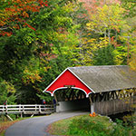
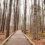
This paved scenic trail provides a smooth path for bicyclists, starting from the intersection of Routes 111 and 28 in Salem, and continuing to a point on North Lowell Road in Windham. This is a scenic stretch of trail, which traverses by a farm pasture, apple orchard, two ponds and marshes, is predominately wooded. There are two bridges that the trail crosses. One is built of New Hampshire granite as an archway and provides a unique architectural significance. Two high stone cuts provide a cool section of passing on hot days, and in the winter support multi-colored ice flow “sculptures.” The trail also passes several stonewalls, and a cellar hole from an 1800’s sawmill.
Trail Map
Piscataquog Trail

Total Length: 2.1 miles

The Piscataquog Trail is a 10 ft wide, paved recreational trail in the West Side of Manchester. The trail is highly utilized by cyclists and pedestrians and allows residents from the West Side of Manchester to the amenities of downtown.  Future phases of the Piscataquog Trail include the rehabilitation of the abandoned railroad trestle bridge crossing the Piscataquog River and linking to the Goffstown Rail Trail and additional trail networks along the West bank of the Piscataquog River. Once complete, the trail will be approximately 3 miles in length. Access Points: West Side Arena, MerchantsAuto.com Stadium, Third Street.
Trail Map