Quantcast


Lakes region is a lovely setting for walking and hiking

Fall Hiking Purity Spring Resort Madison New Hampshire
Purity Spring Resort

1251 Eaton Road (Route 153) East Madison, NH, 03849 Phone: 603-367-8896 Toll-Free: 800-373-3754
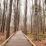
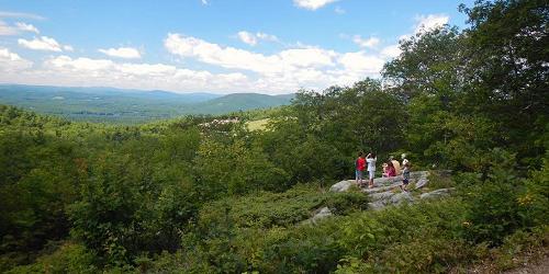
Explore New Hampshire’s Lakes Region on foot

Pack your walking shoes and hiking gear and come to New Hampshire’s Lakes region for a vacation to remember. Nearby you’ll find the summits of the White Mountains reaching over 4,000 feet, or simply head out on Purity Spring Resort’s well maintained trails for fun and exercise with the whole family. There are easy hikes of 15-90 minutes on the Audubon Trails and more moderate hikes that lead you up to great views of the picturesque mountains and places to relax. The resort’s well marked Nordic Ski trails take you up and around Lake Purity where you’ll find the occasional incline for a good cardio workout. One favorite trail leads from the resort to Sunset Beach. Trail maps are available at the Main Office.
Ahern State Park

43 Great Bay Lane Laconia, NH Phone: 603-227-8745

This lakeside park has abundant walking trails. Trail map. See full descriptionof Ahern State Park at our State and Local Parks page.
Squam Range Traverse

Mead Base Camp Sandwich, NH Phone: 603-968-7336

This is a point-to-point hike running across seven named peaks of the Squam Range in the Lakes Region of New Hampshire. There are ample opportunities for views and lots of walking (and scrambling) on open ledges. The elevation gain is 2,900 feet.
The starting point for this hike is Mead Base Camp in Sandwich, New Hampshire and the ending point is the Cotton Mountain Trailhead located in Holderness, New Hampshire. - Trail Map
Wellington State Park

614 West Shore Road (Off Route 3A) Bristol, NH, 03222 Phone: 603-744-2197

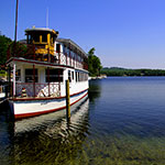
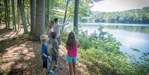
Fresh water swimming, hiking, boat launch, picnicking, beautiful lake and island views

This park on the shore of Newfound Lake has nice nature trails and hiking trails inside and outside the park. A nature trail offers a picnic grove and plant identifications. Another exterior hiking trail from the park leads to the Sugarloafs Mountains, Bear Mountain, Welton Falls, and Mount Cardigan.
See full description of Wellington State Park.
Stonedam Island Conservation Area

Stonedam Island Road Meredith, NH Phone: 603-253-3301

This island is 112 acres with 2.7 miles of undeveloped shoreline. Come to enjoy a peaceful walk on a network of trails. One trail leads to the highest point on Lake Winnipesaukee. Docking for power boats is available at a dock on the northeast shore of the island, across Sallys Gut from the mainland. The island also can be reached by paddle, canoes, and kayaks. The trails, which are signed and blazed, extends from the dock to points of interest elsewhere on the island. The walking loop around the island is 1.5 miles long. Open July - Labor Day.
Blue Job Mountain

Off First Crown Point Road Rochester, NH Phone:

Blue Job Mountain has one of the best views in southern New Hampshire, encompassing Mount Washington, Mount Monadnock, and the Atlantic Ocean. It is a short -- one mile -- and easy walk to the fire tower. There are two routes to the summit and they both start from the same parking area.
Directions: From Route 202A head north on First Crown Point Road. Take First Crown Point Road 5.3 miles north. The trailhead parking area will be on your right just beyond the height of land.
Castle in the Clouds Conservation Area - Moultonborough, NH - Photo Credit Lakes Region Conservation Trust
Castle in the Clouds Conservation Area

455 Old Mountain Road Moultonborough, NH, 03254 Phone: 603-476-5900

The Castle in the Clouds Conservation Area is 5,000 conserved acres with 45 miles of hiking trails to waterfalls, views from mountain summits and outlooks, signs of wildlife, historic sites, and interesting geological features of the Ossipee Mountains.
This property is part of the Ossipee Mountain ring, a circular formation of volcanic origin. Seven of the Ossipee Mountains’s biggest peaks are on the Castle property, including Mount Shaw and Bald Knob, with its view of Lake Winnipesaukee. The trails are well maintained, marked, and mapped.
Two trailhead parking areas are free and open to the public for getting onto the trails during the day. One is on Route 171 and the other is at the end of Ossipee Park Road. A helpful hiking trail map is available for purchase.
Red Hill

Sibley Road and Red Hill Road Center Harbor, NH Phone:

Red Hill, in the Lakes Region, is a popular hiking spot due to the stunning panoramic views from the fire tower. Hikers can see Lake Winnipesaukee to the southeast and Squam Lake to the west. This is a short hike of 1.7 miles to a fire tower; elevation gain is 1,370 feet. Low to moderate difficulty. Distance is a total of 3.5 miles.
Belknap Mountain Trails

Belknap Carriage Road near Belknap Mountain Road Gilford, NH Phone:

This 2-mile climb, rated moderate-to-difficult, takes the hiker to a magnificent view of Lake Winnipesaukee and the Ossipee Mountains from Belknap Mountain from the fire tower at the summit. Elevation is 740 feet. You have a choice of well-marked red-blazed or blue-blazed trails. See website for trail descriptions.
Directions: To reach Belknap Mountain, turn off Route 11A at Gilford and drive south through Gilford Village. Stay on this road past the high school (road makes a sharp left turn) and you’ll begin your climb up Belknap Mountain Road. Follow the road up until you see signs and a parking area on the left.